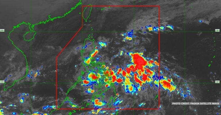
WEATHER UPDATE — According to the Philippine Atmospheric, Geophysical, and Astronomical Services Administration (PAGASA), the Low-Pressure Area (LPA) has been spotted inside the Philippine Area of Responsibility (PAR) at 610 km East of Hinatuan, Surigao del Sur. The LPA may also develop into a Tropical Depression within 36 hours.
The LPA entered PAR yesterday and brings rains over most of the country, such as Southern Luzon, Visayas, and Mindanao. Meanwhile, the shear line continues to affect Northern Luzon.
According to PAGASA’s Tropical Cyclon (TC) Threat Potential forecast, the LPA will likely move in a west-northwest direction in the next 24 hours. It will be near the CARAGA region and Eastern Visayas.
The LPA is forecast to move towards Northern Samar and Bicol region tomorrow. Then, on Sunday, it is expected east of Quezon and Aurora Provinces, moving northward.
By Monday, it is forecast to be east of Cagayan Valley. By then, the weather agency is uncertain whether the LPA will recurve and move away from the country or continue moving towards the east of Batanes.
The LPA has a high chance of becoming a Tropical Depression within 36 hours. It will be named Rosal, the 18th tropical depression to enter the PAR in 2022.
WEATHER TODAY – DECEMBER 9, 2022
For today’s weather forecast, Luzon is affected by the shear line and the LPA. There are high chances of heavy rains over the Bicol region, Quezon provinces, Rizal, Laguna, Batangas, Marinduque, Romblon, and Oriental Mindoro.
Meanwhile, the shear line affects Ilocos Norte, Apayao, and Cagayan. Residents are warned of heavy rains, causing flash floods and landslides.
Areas in Extreme Northern Luzon, including Batanes, are forecast to have cloudy skies with chances of rain due to the Northeast Monsoon (Amihan).
Metro Manila and the rest of Luzon may expect partly cloudy to cloudy skies with chances of rain and localized thunderstorms in the afternoon and evening.
Visayas and Mindanao are forecast to have cloudy skies with heavy rains for the rest of the day due to the LPA moving near the CARAGA region and Eastern Visayas.
Residents are urged to be updated with Thunderstorm, Rainfall, and Heavy Rainfall advisories by PAGASA regional offices.
A gale warning continues to be issued due to the Amihan. The following areas are warned of waves reaching 2.8 to 5 meters: Batanes, the Northern coast of Cagayan, including Babuyan Islands, Ilocos Norte, Ilocos Sur, La Union, and Pangasinan.
Watch the 5 AM weather update today below:
– WhatALife!
Source: (PAGASA)
Also read: Cloud clusters outside PAR being monitored


Leave a Reply