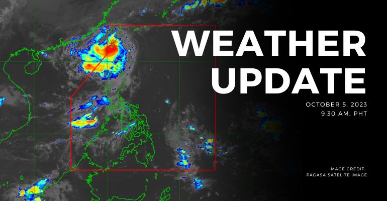
WEATHER UPDATE — According to the Philippines Atmospheric, Geophysical, and Astronomical Services Administration (PAGASA), the center of the eye of Typhoon “JENNY” {KOINU} was estimated based on all available data at 130 km North Northwest of Itbayat, Batanes (21.8°N, 121.2°E) with maximum sustained winds of 175 km/h near the center and gustiness of up to 215 km/h at 3:00 AM today. It is moving Westward at 10 km/h. Southwest Monsoon affects Central Luzon, Southern Luzon, and Visayas.
Weather Update Today – October 5, 2023
PAGASA’s weather update today (October 5, 2023) says Batanes will experience stormy weather conditions caused by Typhoon Jenny. Possible flooding or landslides due to moderate to heavy rains. Possible flooding or landslides due to moderate to heavy rains. Minor to moderate threat to lives and properties due to strong winds.
Meanwhile, Babuyan Islands, Apayao, and Ilocos Norte, will experience rains with gusty winds caused by the typhoon. Possible flooding or landslides due to moderate to heavy rains. Minimal to minor threat to lives and properties due to strong winds.
As for the rest of Cagayan Valley, Cordillera Administrative Region, and Ilocos Region, people will likely experience cloudy skies with scattered rain showers and thunderstorms caused by the trough of typhoon Jenny. Possible flash floods or landslides due to moderate to, at times, heavy rains.
Metro Manila, Central Luzon, CALABARZON, and MIMAROPA will experience cloudy skies with scattered rain showers and thunderstorms caused by the Southwest Monsoon. Possible flash floods or landslides due to moderate to, at times, heavy rains.
With the rest of the country, there are partly cloudy to cloudy skies with isolated rain showers or thunderstorms caused by the Southwest Monsoon or localized thunderstorms. Possible flash floods or landslides during severe thunderstorms.
According to PAGASA’s Forecast Wind and Coastal Water Condition, Extreme Northern Luzon has strong wind speeds from west to southwest with rough coastal water (2.8 to 6.0 meters).
Meanwhile, the rest of Luzon has moderate to strong wind speeds from west to southwest with moderate to rough (1.2 to 4.0 meters) coastal water conditions.
On the other hand, Visayas and Mindanao have light to moderate wind speeds directed from the south to southwest with slight to moderate (0.6 to 2.5 meters) coastal water conditions.
Tropical Cyclone Warning: Typhoon Jenny (KOINU) Signal #1
A tropical cyclone will affect the locality. Winds of 39-61 kph or intermittent rains may be expected within 36 hours.
- Ilocos Norte
- Apayao
- Cagayan
Tropical Cyclone Warning: Typhoon Jenny (KOINU) Signal #3
A tropical cyclone will affect the locality. Winds of 89 kph up to 117 kph may be expected in at least 18 hours.
- Batanes
Under present weather conditions, At 3:00 AM today, the center of the eye of Typhoon “JENNY” {KOINU} was estimated based on all available data at 130 km North Northwest of Itbayat, Batanes (21.8°N, 121.2°E) with maximum sustained winds of 175 km/h near the center and gustiness of up to 215 km/h. It is moving Westward at 10 km/h. Southwest Monsoon affects Central Luzon, Southern Luzon, and Visayas. The 12-hour rainfall forecast is light to moderate rains.
WATERCOURSES STILL LIKELY TO BE AFFECTED :
- Batanes
- Ilocos Norte
- Apayao
The 12-hour rainfall forecast is light to moderate rains and thunderstorms.
- Bataan
- Zambales
- Occidental Mindoro
- Oriental Mindoro
The 12-hour rainfall forecast is light to occasionally moderate rains and thunderstorms.
- Cavite
People living near the mountain slopes and in the low-lying areas of the above-mentioned river systems and the Local Disaster Risk Reduction and Management Councils concerned are still advised to take necessary precautionary measures.
Source: (PAGASA)
Also read: PAGASA: Typhoon ‘JENNY’ Nears Itbayat, Batanes with 150 km/h Winds


Leave a Reply