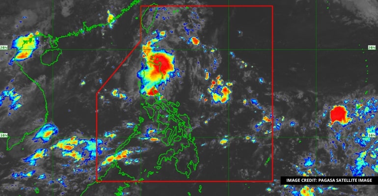
WEATHER UPDATE — According to the Philippines Atmospheric, Geophysical, and Astronomical Services Administration (PAGASA), the Low-Pressure Area (LPA) was located 260 km East of Infanta, Quezon, at 3:00 AM today. The Intertropical Convergence Zone will also affect Southern Luzon, Visayas, and Mindanao again.
Coastal water conditions will be normal, with winds on Palawan, Visayas, and Mindanao directing from Southwest to Southeast with light to moderate speed. Coastal waters will range from 0.6 to 2.1 meters in height. Like the rest of Luzon, winds from East to Southeast will affect the country with light to moderate speed and coastal waters ranging from 0.6 to 2.1 meters in height.
Weather Today – June 27, 2023
Areas in MIMAROPA, Bicol Region, Cagayan Valley, Aurora, and Quezon will be affected by cloudy skies with scattered rain showers and thunderstorms caused by the ITCZ and LPA that is resonating around the Philippine Area of Responsibility.
There will also be possible flash floods or landslides because of the heavy rains caused by the LPA and ITCZ, so cautionary actions are advised in the listed areas.
Metro Manila and the rest of the country will be partly cloudy and experience isolated rain showers and thunderstorms caused by the ITCZ and Localized Thunderstorms from the other areas.
The areas will also have a possibility of experiencing flash floods or landslides depending on the area with severe thunderstorms.
PAGASA then issued a flood advisory in the following areas after the weather broadcast:
- Aurora
- Quezon
- Rizal
– WhatALife!/Zain
Source: (1)
Also read: PAGASA: Rainy Friday Due to ITCZ


Leave a Reply