WEATHER UPDATE — According to the Philippine Atmospheric, Geophysical, and Astronomical Services Administration (PAGASA), the Low-Pressure Area currently being monitored is spotted 195 km north of Legazpi City. The LPA and the shear line brings rain over Southern Luzon.
The weather agency reports that the LPA is currently moving north-northeast, away from the country. However, PAGASA has not removed the possibility of the LPA turning into a Tropical Storm.
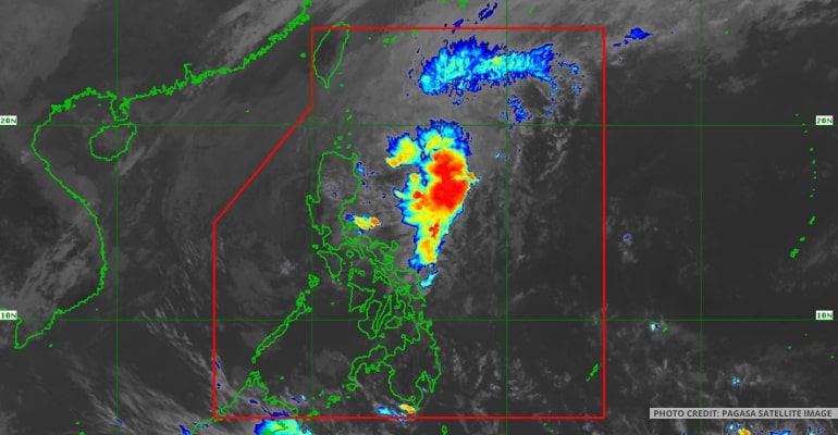
As seen in PAGASA’s satellite image, the LPA and shear line bring rains over Southern Luzon. Meanwhile, the prevailing Northeast Monsoon or Amihan continues to bring colder weather and rain over Northern Luzon.
WEATHER TODAY – FEBRUARY 20, 2023
For today’s weather forecast, mainland Cagayan, Isabela, Aurora, Quezon, and the Bicol Region may experience cloudy skies with isolated rain showers and thunderstorms due to the shear line and LPA.
Due to the Northeast Monsoon, Cagayan Valley, CAR, and Ilocos Norte will have cloudy skies with chances of rain.
Areas in Mimaropa may expect fair weather with chances of isolated rainshowers and thunderstorms. Meanwhile, Metro Manila and the rest of Luzon are forecast to have fair weather with chances of light rains.
The Low-Pressure Area inside PAR will bring rains and thunderstorms over Northern Samar. However, the rest of Visayas and Mindanao may experience fair weather with chances of isolated rainshowers and thunderstorms.
PAGASA has also released gale warnings today for the following coastal areas:
- Batanes
- Cagayan including Babuyan Islands
- Isabela
- Aurora
- Quezon including Polillo Islands
- Camarines Norte
Watch the 4 AM weather update today below:
– WhatALife!
Source: (PAGASA)
Also read: PAGASA: Two Low-Pressure Areas (LPA) may merge within 24 hours


Leave a Reply