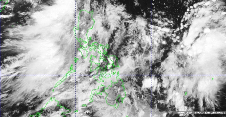
On August 18, Thursday, the Philippine Atmospheric, Geophysical and Astronomical Services Administration (PAGASA) said they are still continuing to monitor the LPA (Low-Pressure Area) within the PAR (Philippine Area of Responsibility).
“As of three in the morning, it is 160 km East of Kalayan, Cagayan,” PAGASA forecaster Benison Estareja reported.
The agency expects on this day that the LPA will continue moving westward bypassing the islands of Batanes and Babuyan, and they expect that within 24 hours it will leave the PAR. This LPA has a low chance of becoming a storm, but we can still expect it to cause rain in most of Luzon, this causes include the Southwest Monsoon,
The agency has also spotted cloud clusters in the Southeastern part of Mindanao causing rain there as early as this morning but is not expected to become a full-fledged storm. They continue to monitor it as it is possible for it to become an LPA.
Moreover, according to the forecast for Ilocos Region, Cordillera Administrative Region, Batanes, Cagayan, Isabela, Zambales, Bataan, Aurora, and Quezon, these areas will experience cloudy skies with scattered rain showers and thunderstorms. As a result, they may experience periods of moderate to primarily heavy rain, and areas could experience flash floods or landslides.
On the other hand, Metro Manila and the rest of the country will experience partly cloudy skies with isolated rain showers or thunderstorms.
PAGASA warned that landslides or flash floods are still possible during heavy thunderstorms.
For areas in Luzon and Visayas, they can expect some light to moderate winds and slight to moderate waves. At the same time, areas of Mindanao will also have light to moderate winds and slight to moderate waves. –WhatALife!/Zed
Also Read: PAGASA: Southwest Monsoon continues affecting the western section of Northern and Central Luzon

Leave a Reply