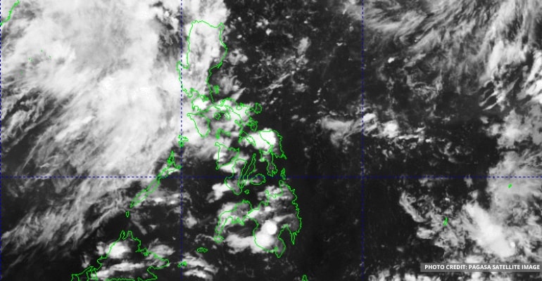
WEATHER UPDATE — On August 11, 2022, the Philippine Atmospheric, Geophysical and Astronomical Services Administration (PAGASA) spotted a few weather disturbances that are far from the Philippine Area of Responsibility (PAR).
A Low-Pressure Area (LPA) was spotted in the Northeastern section of PAR, as well as in Southern China, which is also moving away from our country.
The southwest monsoon (habagat) continues to weaken, PAGASA forecaster Benison Estareja reported.
“The southwest monsoon now only affects western of Central Luzon, and we can expect rain showers in areas of Luzon today,” he said.
Bataan, Zambales, and Kalayaan Islands will experience scattered rain showers and thunderstorms. As a result, they may experience periods of moderate to primarily heavy rain, and areas could experience flash floods or landslides.
On the other hand, Metro Manila and the rest of the country will experience isolated rain showers or thunderstorms.
PAGASA warned that landslides or flash floods are still possible during heavy thunderstorms.
For areas in Mindanao, light to moderate winds and mild to moderate waves are expected. At the same time, parts of Luzon and the Visayas will continue to have moderate to intense winds and moderate to rough seas.
Watch PAGASA’s latest weather forecast below:
–WhatALife!/Zed
Also read: Weather Update: Low-Pressure Area (LPA) left the PAR

Leave a Reply