MANILA, PHILIPPINES — Typhoon Mawar has intensified into a super typhoon. Mawar is expected to enter the Philippine Area of Responsibility (PAR) on Friday.
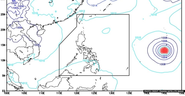
The Philippine Atmospheric, Geophysical and Astronomical Services Administration (PAGASA) stated that typhoon Mawar (to be named Betty once it enters the PAR) intensified into a super typhoon around 2 PM on May 23. It was spotted 2,285 kilometers East of the Visayas at 3 PM.
PAGASA mentioned the typhoon will strengthen the southwesterly windflow by the time it enters PAR on Friday night or Saturday morning. As the typhoon proceeds to advance northwestward, it will cause more rains and thunderstorms to the western sections of Visayas and Mindanao.
Despite being outside the PAR, the typhoon is causing rains over parts of Northern Luzon.
The super typhoon maintains winds of 185 km/h near the center and gustiness of 230 km/h. It is moving northward at 15 km/h and is expected to move northwestward in the coming days.
The southwesterly windflow being affected by the typhoon will bring rain showers over Palawan, Manila, and the rest of the country, with the frontal system bringing rains over Batanes and Babuyan Islands.
The Department of the Interior and Local Government (DILG) Secretary Benjamin Abalos ordered local government units (LGUs) to brace for the upcoming super typhoon Mawar.
DILG chief stated LGUs in areas prone to landslides or floods should implement critical preparedness actions, suggesting they acquire supplies and equipment pre-positioned.
Abalos hopes to aim for zero casualties nationwide by encouraging LGUs to take preventive measures for Mawar.
“We need to brace ourselves and get ready to avoid casualties and other damages expected to be brought about by this potential weather disturbance,” he also stated. – WhatALife!/Zain


Leave a Reply