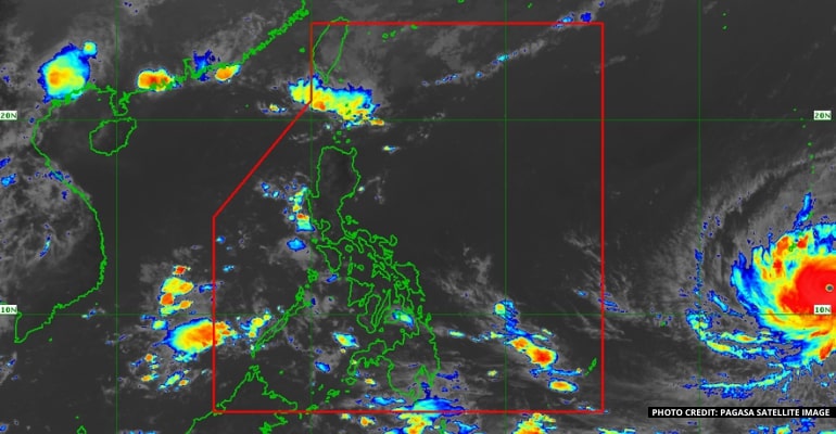
MANILA, PHILIPPINES — The Philippine Atmospheric, Geophysical and Astronomical Services Administration (PAGASA) stated the tropical cyclone outside the Philippine Area of Responsibility (PAR) will be expected to develop into a super typhoon within 24 hours.
PAGASA weather forecast Ana Clauren-Jorda said that typhoon Mawar was located 2,330km east of Mindanao. The typhoon has a maximum sustained wind of 155 kph nearing up to 190 kph.
“We don’t see that it will have a landfall scenario in any part of the country but we still advise the public to prepare for possible strong rains,” Clauren-Jorda stated in the weather forecast.
The tropical cyclone will enhance the southwest monsoon, so rains will be expected in the western section of the country.
Clauren-Jorda also said that the country would be expecting rains over the weekend, especially in the western portions also prone to flooding.
The typhoon will be expected to enter the country around Friday or Saturday. After it enters, the super typhoon will be named Betty.
PAGASA expects one typhoon in May, two typhoons in June, two to three typhoons in July, August, and possibly in September. – WhatALife!/Zain

Leave a Reply