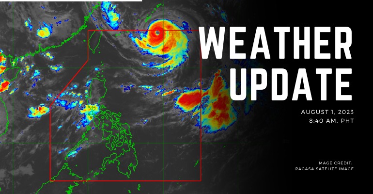
WEATHER UPDATE — According to the Philippines Atmospheric, Geophysical, and Astronomical Services Administration (PAGASA), the center of the eye of Typhoon FALCON, was estimated at 930 km East Northern Luzon with maximum sustained winds of 175 km/h near the center and gustiness of up to 215 km/h with all available data. Typhoon Falcon is currently moving Northwestward at 20 km/h. Southwest Monsoon affects Luzon and Visayas as well.
Weather Today – August 1, 2023
Zambales and Bataan will have Monsoon rains caused by the Southwest Monsoon, causing possible flooding or landslides due to scattered to widespread heavy rains. Typhoon Falcon has also caused the area to have strong winds not only in Northern Luzon but also in Visayas and Mindanao.
Metro Manila, Pangasinan, Pampanga, Bulacan, and Occidental Mindoro will have occasional rains with mostly fair weather caused by the Southwest Monsoon and Typhoon Falcon, with possible flooding or landslides that is from heavy rains.
Cordillera Administrative Region, Cagayan Valley, CALABARZON, the rest of Ilocos Region, the rest of Central Luzon, the rest of MIMAROPA, and Antique will have weather conditions of cloudy skies with scattered rain showers and thunderstorms caused by Southwest Monsoon and trough of typhoon Falcon. There is also a possibility of flash floods or landslides due to moderate and heavy rains.
The rest of the country will have partly cloudy skies with isolated rain showers or thunderstorms by Southwest Monsoon or localized thunderstorms, causing possible flash floods or landslides during thunderstorms.
PAGASA has also issued an extreme level flooding advisory. The listed areas are:
- Ilocos Sur
- Ilocos Norte
- La Union
- Pangasinan
- Bataan
- Zambales
– WhatALife!/Zain
Source: (PAGASA)
Also read: PAGASA: Typhoon FALCON Spotted East of Northern Luzon

Leave a Reply