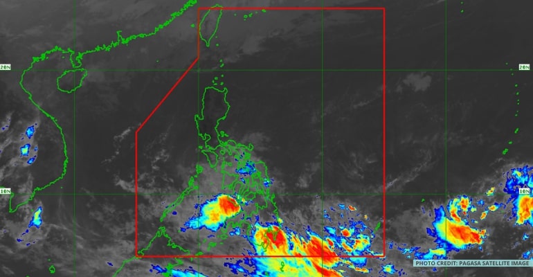
WEATHER UPDATE — According to the Philippine Atmospheric, Geophysical, and Astronomical Services Administration (PAGASA), the trough or extension of the Low-Pressure Area (LPA) spotted outside of the Philippine Area of Responsibility (PAR) continues to bring rain over Mindanao and parts of Visayas. It may also enter PAR within the next 24 to 48 hours.
The trough of the LPA is affecting the weather condition of Mindanao and parts of Eastern Visayas. While it may enter PAR in the next few days, it still has a low chance of turning into a Tropical Storm.
Meanwhile, the Northeast Monsoon or Amihan continues to bring colder weather and light rains to Northern Luzon.
WEATHER TODAY – FEBRUARY 14, 2023
For today’s weather forecast, the majority of Luzon, including Metro Manila, will have fair weather with chances of isolated rain showers. Meanwhile, Palawan may expect fair weather with chances of rains brought by localized thunderstorms.
Temperatures in Luzon range from 20 degrees Celsius to 32 degrees Celsius.
Due to the trough or extension of the LPA, Visayas and Mindanao are forecast to experience moderate to heavy rains.
Temperatures range from 24 degrees Celsius to 31 degrees Celsius.
At the moment, PAGASA has issued a gale warning to Batanes and Babuyan Islands.
Watch the 4 AM weather update today below:
– WhatALife!
Source: (PAGASA)
Also read: PAGASA: Trough of LPA outside PAR affecting Mindanao


Leave a Reply