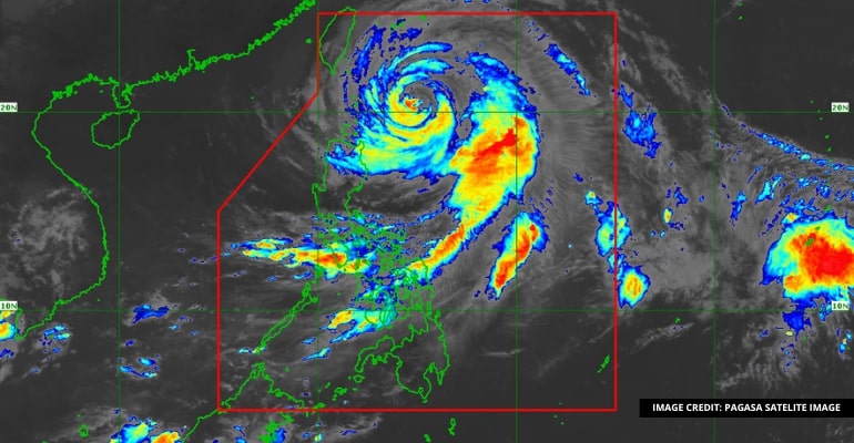
WEATHER UPDATE — According to Philippine Atmospheric, Geophysical and Astronomical Services Administration (PAGASA), the center of the eye of Typhoon “Betty” (Mawar) was estimated based on all available data at 360 km East of Basco, Batanes with maximum sustained winds of 150 km/h near its center and has 185 km/h of gustiness. The cyclone is currently moving Northwestward at 10 km/h.
As stated on PAGASA’s weather forecast, typhoon “Betty” may exit the Philippine Area of Responsibility (PAR) on Friday and may be downgraded into a severe tropical storm instead of super typhoon.
Weather Today – May 30, 2023
Typhoon Betty will be affecting Batanes, Cagayan, Cordillera Administrative Region, Ilocos Norte, Ilocos Sur, Isabela, and Aurora. Listed areas will be affected with storm, rains, and gusty winds that may cause flooding or landslides due to moderate or heavy rain . There will be minor threats to lives and properties due to the strong winds.
Southwest Monsoon will be affecting MIMAROPA, Western Visayas, Zamboanga Peninsula, rest of Ilocos Region, rest of Cagayan Valley, Metro Manila, and the rest of the country. The Southwest Monsoon will cause cloudy skies and scattered rain showers with thunderstorms causing flash floods and landslides due to heavy rain as well. There will be no threats however cautionary actions are advised by PAGASA from the weather conditions.
PAGASA has issued a Tropical Cyclone Wind Signaly #2: Strong Winds in the following areas:
- Batanes
- Northeastern portion of Cagayan
- Babuyan Islands
PAGASA issued TCWS #1: Strong winds in following areas:
- Rest of Mainland Cagayan
- Northern and Eastern portions of Isabela
- Apayao
- Eastern portion of Ilocos Norte
- Northeastern portion of Abra
- Northeastern portion of Kalinga
– WhatALife!/Zain
Source: (1)
Also read: PAGASA: Super Typhoon Mawar Spotted Near East of South Luzon

Leave a Reply