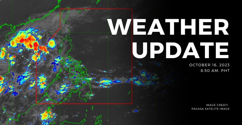
WEATHER UPDATE — According to the Philippines Atmospheric, Geophysical, and Astronomical Services Administration (PAGASA), the North Luzon will be hit by Northeasterly surface wind flow.
Weather Update Today – October 16, 2023
PAGASA’s weather update today (October 16, 2023) Palawan will experience cloudy skies with scattered rain showers and thunderstorms caused by the trough of LPA. Possible flash floods or landslides due to moderate to, at times, heavy rains.
Batanes, Cagayan, Isabela, and Apayao will experience partly cloudy to cloudy skies with isolated rain showers or thunderstorms caused by Northeasterly surface wind flow. It has no significant impact.
Meanwhile, Metro Manila and the rest of the country will experience partly cloudy to cloudy skies with isolated rain showers or thunderstorms caused by localized thunderstorms. Possible flash floods or landslides due to moderate to, at times, heavy rains.
According to PAGASA’s Forecast Wind and Coastal Water Condition, Northern and Central Luzon has moderate to strong wind speeds from northeast to southeast with moderate to rough coastal water (1.2 to 2.8 meters).
As for the rest of the country, the areas have light to moderate wind speeds from northeast to southeast with slight to moderate (0.6 to 2.1 meters) coastal water conditions.
Currently, there are no current alerts and advisories for light to severe hazards and weather disturbances for tropical cyclones, flood storm surge, thunderstorm, and rainfall.
Source: (PAGASA)
Also read: PAGASA: Low Pressure Area Approaches Puerto Princesa, Palawan

Leave a Reply