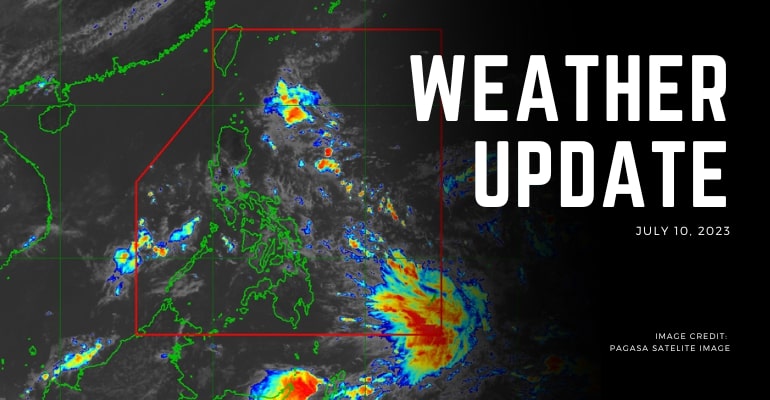
WEATHER UPDATE — According to the Philippines Atmospheric, Geophysical, and Astronomical Services Administration (PAGASA), Intertropical Convergence Zone (ITCZ) will affect Southern Mindanao, the Intertropical Convergence Zone (ITCZ) will be affecting Palawan, Visayas, and Mindanao, causing rain showers and thunderstorms.
Forecast wind and coastal water conditions will be normal. Luzon and Visayas will have light to moderate speed winds directed from northeast to Northwest, with the coastal water condition being slight to moderate height.
Mindanao will also have light to moderate wind speeds from Northwest to West, with coastal water conditions benign at a slight to moderate height.
Weather Today – July 10, 2023
Visayas, Caraga, Northern Mindanao, Zamboanga Peninsula, and Palawan will be experiencing cloudy skies with scattered rain showers and thunderstorms that is caused by the ITCZ, which may impact the areas with the possibility of flash floods or landslides due to moderate to heavy rains.
Metro Manila and the rest of the country will experience partly cloudy to cloudy skies with isolated rain showers and thunderstorms that are caused by the ITCZ and localized thunderstorms that may have the areas also experience possible flash floods or landslides during severe thunderstorms.
PAGASA has issued a general flood advisory in several areas.
The listed areas for the possibility of flood area:
- Southern Leyte
- Samar
- Leyte
- Lanao Del Norte
- Misamis Occidental
- Bukidnon
- Zamboanga Del Sur
- Zamboanga Sibugay
- Zamboanga Del Norte
Flood advisories with severe threat of flooding are in these areas:
- Lanao Del Sur
- Maguindanao
- BARMM
– WhatALife!/Zain
Source: (1)

Leave a Reply