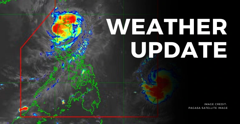
The Philippine Atmospheric, Geophysical, and Astronomical Services Administration (PAGASA) has confirmed that severe tropical storm Pepito (international name: Man-yi) entered the Philippine Area of Responsibility (PAR) on Thursday night.
The latest typhoon Pepito update shows that it entered at 8:00 p.m. It is positioning itself approximately 1,375 kilometers east of Northeastern Mindanao.
This Pepito typhoon update reveals that the storm may strengthen into a typhoon by Friday morning as it continues its westward movement at 25 km/h.
In addition to that, the tropical storm has a maximum sustained winds of 110 km/h near the center and gustiness reaching up to 135 km/h. Pepito can develop into a super typhoon, potentially making landfall over the eastern coast of Southern Luzon this weekend.
Also Read: PAGASA Issues Signal No. 1 for Northern Luzon as Tropical Storm Ofel Approaches
PAGASA has advised residents and maritime operators along the eastern seaboard to stay alert. This is because hazardous sea conditions could emerge by late Friday or early Saturday.
This update on typhoon Pepito indicates that the storm will affect large portions of Eastern Visayas and Southern Luzon. This is in particular to those areas expected to experience heavy rainfall and strong winds.
As it continues to track westward, the typhoon Pepito update today in the Philippines urges Filipinos to stay informed and vigilant. Coastal communities, particularly in Southern Luzon, should be prepared for possible disruptions and heed local advisories on evacuation if necessary.
To know more about the typhoon update and its current status, read the details below!
How is Typhoon Pepito expected to impact Southern Luzon based on the latest Bagyong Pepito update?
The storm is forecasted to intensify and may become a super typhoon. According to the Pepito typhoon update from PAGASA, Pepito is moving westward and is expected to make landfall over Southern Luzon by the weekend. That said, residents in the region, especially those in coastal areas, should closely monitor the update on typhoon Pepito and prepare for potentially hazardous sea conditions.
Local authorities may issue advisories regarding evacuation, especially in areas like Calabarzon.
Also Read: How to File for Typhoon Carina Calamity Loan in the Philippines (SSS, GSIS, Pag-IBIG)
What is the current track of Typhoon Pepito, and where is it expected to land?
The latest bagyong Pepito 2024 update shows that the storm entered the Philippine Area of Responsibility (PAR) on Thursday night. With its trajectory, bagyong Pepito is likely to make landfall, specifically on the eastern coast, within the next few days.
The Typhoon Pepito 2024 track live shows that regions like Metro Manila and parts of Eastern Visayas should be on high alert as the storm strengthens and approaches.
How does PAGASA predict the potential intensification of Pepito and its status as a super typhoon?
The latest DOST PAGASA weather update today confirms that Pepito has sustained winds of 110 km/h with gusts reaching 135 km/h. The storm is expected to intensify as it tracks westward. That said it leads to severe weather conditions that could affect large parts of the country.
PAGASA continues to monitor its progress and urges the public to stay updated, especially as the storm could bring hazardous weather conditions similar to typhoon Ofel.
Keep Reading: LOOK: List of Typhoon Emergency, Rescue Hotlines

Leave a Reply