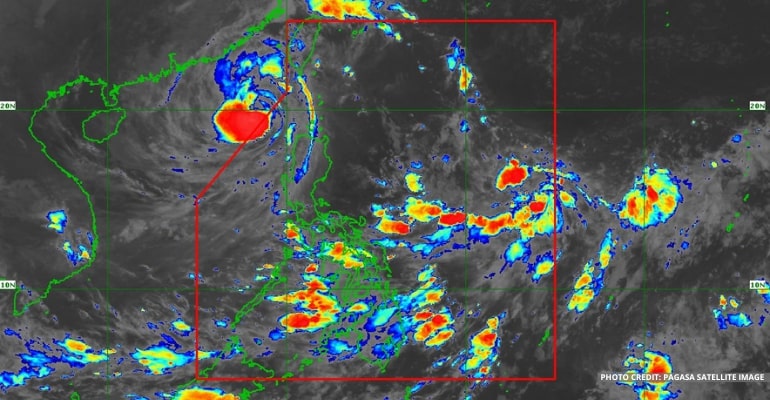
WEATHER UPDATE — According to the Philippine Atmospheric, Geophysical and Astronomical Services Administration (PAGASA), Bagyong Neneng exited the Philippine Area of Responsibility (PAR) at around 8:00 pm yesterday, October 16, 2022. Its trough continues to affect the western section of Northern Luzon.
Bagyong Neneng (now Typhoon Nesat) officially exited PAR yesterday evening and is making its way to Hainan Province, China. However, its trough continues to affect the western section of Northern Luzon, resulting in gale warnings. Waves are expected to reach up to 4 meters high.
A Southwesterly Surface Windflow affects Western Visayas and the rest of the country.
Meanwhile, a Low-Pressure Area (LPA) may form east of Visayas.
For today’s weather forecast, Palawan and the Ilocos Province may expect cloudy skies, isolated rainshowers, and thunderstorms due to the trough of Bagyong Neneng.
The rest of Luzon has fair weather conditions with chances of thunderstorms in the afternoon or evening.
Western Visayas may experience cloudy skies, isolated rainshowers, and thunderstorms due to the Southwesterly Surface Windflow. The rest of Visayas and Mindanao will have fair weather conditions with chances of isolated rainshowers due to thunderstorms.
Gale Warning as of October 17, 2022, 4:00 am
Northern and Western Seaboards of Northern Luzon
- Batanes
- Babuyan Islands
- Ilocos Norte
- Ilocos Sur
- La Union
- Pangasinan
Watch the 5 am PAGASA Weather Update here:
– WhatALife!
Also read: PAGASA: Bagyong Neneng now in PAR, may intensify as Tropical Storm


Leave a Reply