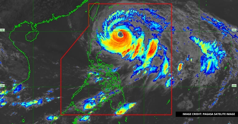
MANILA, PHILIPPINES — Typhoon “Betty” continues its trajectory over the waters east of Cagayan, slightly decelerating as it moves northwestward. The center of the eye of Typhoon ‘Betty’ was estimated based on all available data at 470 km East of Aparri, Cagayan or 475 km East of Calayan, Cagayan (19.1 °N, 126.0 °E ).
The typhoon’s impact on land areas and coastal waters is expected to bring heavy rainfall, severe winds, and potential hazards. As the storm progresses, it is crucial for residents in affected regions to remain vigilant and take necessary precautions.
Heavy Rainfall Outlook:
The forecast predicts significant rainfall across various regions within specific time frames. The following areas are likely to experience substantial rainfall:
- Today to Tomorrow Morning: The eastern portion of Babuyan Islands and the northeastern portion of mainland Cagayan, with expected rainfall ranging from 50-100 mm.
- Tomorrow Morning to Wednesday Morning: Batanes and the eastern portion of Babuyan Islands, with anticipated rainfall between 100-200 mm. Additionally, the rest of Babuyan Islands, the northern portion of mainland Cagayan, Ilocos Norte, Ilocos Sur, La Union, Abra, and Benguet may expect rainfall ranging from 50-100 mm.
- Wednesday Morning to Thursday Morning: Batanes, the southern portion of Ilocos Sur, La Union, and the western portion of Benguet may experience rainfall between 100-200 mm. The rest of the Ilocos Region, Babuyan Islands, Abra, and the remaining parts of Benguet may anticipate rainfall between 50-100 mm.
- Thursday Morning to Friday Morning: Batanes, Ilocos Region, Abra, and the western portion of Benguet may expect rainfall ranging from 50-100 mm.
Under these conditions, there is a significant risk of flooding and rain-induced landslides, especially in areas prone to such hazards. Localities identified as highly susceptible and those already experiencing significant rainfall in recent days should exercise caution.
Severe Winds:
Gale-force winds may impact areas where Wind Signal No. 2 is hoisted, resulting in minor to moderate effects. Areas under Wind Signal No. 1 may experience strong winds ranging from strong breeze to near gale strength, leading to minimal to minor impacts.
Typhoon “Betty” is expected to enhance the Southwest Monsoon, potentially causing occasional gusts in certain regions over the next 24 hours.
Hazards Affecting Coastal Waters:
Due to the influence of Typhoon “Betty,” a marine gale warning remains in effect for several coastal areas, including the northern and eastern seaboards of Northern Luzon, eastern seaboards of Central Luzon, the eastern and southern seaboards of Southern Luzon, the eastern and western seaboards of Visayas, and the eastern seaboard of Mindanao.
The public is advised to refer to Gale Warning #4 issued at 5:00 AM today for detailed information.
Track and Intensity Outlook:
As per the track forecast, Typhoon “Betty” is expected to continue moving northwestward slowly today. From tomorrow to Wednesday, it may become slow-moving or almost stationary over the waters east of Batanes.
Subsequently, the typhoon is projected to turn north northeastward or northeastward by late Wednesday or Thursday and gradually accelerate towards the waters east of Taiwan and the southern portion of Ryukyu Islands. Typhoon “Betty” is anticipated to exit the Philippine Area of Responsibility (PAR) on Friday.
The storm is forecasted to weaken steadily over the next five days due to cooler ocean waters and dry air intrusion. It may be downgraded to a severe tropical storm by late Thursday or early Friday. – WhatALife!/Jayve


Leave a Reply