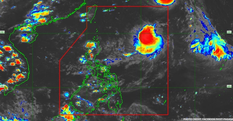
WEATHER UPDATE — On Tuesday, August 30, 2022, at 4:00 AM, PAGASA reported an LPA (Low-Pressure Area) was estimated at 1,210 km East of Extreme Northern Luzon (19.4°N, 133.5°E) based on all available data.
The cloud cluster east of Nothern Luzon has become an LPA, and today it was last seen over a thousand kilometers east of the Extreme Northern Luzon. The LPA is still far from the country.
The tropical storm outside the PAR (Philippine area of responsibility) that was being monitored has become a full-fledged typhoon (international name “Hinnamnor”). It is expected to move westward, and it may enter PAR tomorrow or Thursday.
“Its movements may hit the Taiwan and Batanes area, and due to this, we may expect the raising of Tropical Cyclone Wind Signal No. 1 in the area of Northern Luzon in the coming days,” PAGASA forecaster Aldczar Aurelio said.
The LPA may have a possibility of becoming a storm, and the storm out the PAR may absorb the LPA.
Currently, there is no Southwest Monsoon (Habagat), and the one affecting the country is the Easterlies affecting the eastern sections of Visayas and Mindanao.
Metro Manila and the rest of the country will experience partly cloudy skies with isolated rainshowers or thunderstorms. Due to rains, these areas could experience possible flash floods or landslides during severe thunderstorms.
Luzon will also expect Light to Moderate winds and Slight to Moderate waves at 0.6 to 2.1 meters. Meanwhile, Visayas and Mindanao can expect Light to Moderate winds and Slight to Moderate waves at 0.6 to 2.1 meters.
See the latest PAGASA Weather Forecast below:
–WhatALife!/Zed
Also Read: PAGASA: ITCZ (Intertropical Convergence Zone) affecting Visayas


Leave a Reply