Typhoon Bising continues to weaken as it moves away from eastern provinces in the Philippines.
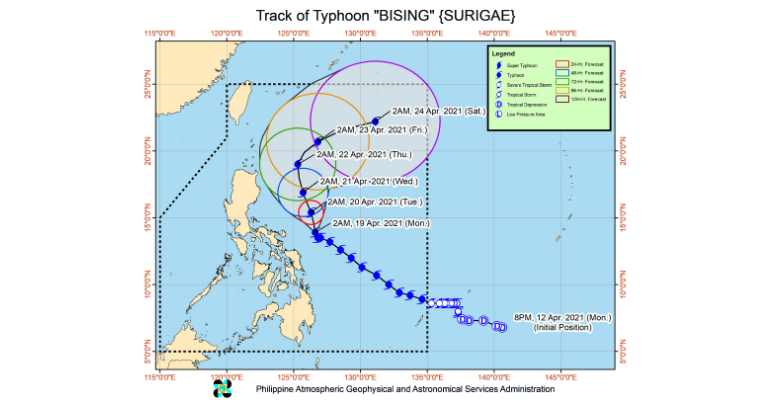
Typhoon Bising (international name Surigae) has gradually weakened while moving north-northwestward at 10 km/h over the Philippine Sea east-northeast of Cantanduanes, the Philippine Atmospheric, Geophysical and Astronomical Services Administration (PAGASA) said on Monday, April 19.
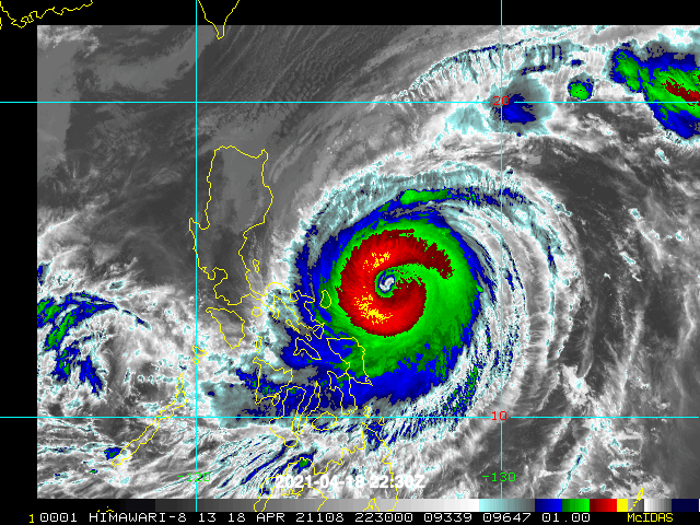
The first super typhoon of the season in the West Pacific made a close landfall to the eastern part of the country over the weekend.
In its 5 AM severe weather bulletin, PAGASA said the eye of Typhoon Bising was located at 250 km East Northeast of Virac, Catanduanes with maximum sustained winds of 195 km/h near the center and gustiness of up to 240 km/h.
Moderate to heavy with at times intense rains will be experienced over Bicol Region, Northern Samar, Samar, Eastern Samar, Biliran, and Leyte.
Tropical Cycling Wind Signal (TCWS) No. 2 remains hoisted over Catanduanes, Northern Samar, Eastern Samar, and Biliran.
The weather bureau warned the residents in these areas of possible light to moderate damage to structures and vegetation due to strong winds and flash floods or landslides due to moderate to heavy rains.
Meanwhile, areas under TWCS No. 1 are the eastern portion of Isabela (Divilacan, Palanan, Dinapigue), the northern portion of Aurora (Casiguran, Dilasag), the southeastern portion of Quezon (Guinayangan, Calauag, Tagkawayan), including Polillo Islands, Camarines Norte, the rest of Camarines Sur, the rest of Albay, the rest of Sorsogon, and Masbate including Burias and Ticao Islands; Leyte, Southern Leyte, and the northern portion of Cebu (Tabogon, Borbon, San Remigio, Bogo City, Medellin, Daanbantayan) including Bantayan and Camotes Islands; and Dinagat Islands, Siargao Islands, and Bucas Grande Islands.
In the next 24 hours, very rough to very high seas will be experienced over the eastern seaboard of Luzon and rough to very high seas over the northern and eastern seaboards of Eastern Visayas.
PAGASA advised that sea travel is risky for all types of seacraft over these waters. However, the typhoon is forecast to maintain its current intensity in the next 12 to 24 hours before gradually weakening throughout the forecast period, the weather bureau added.
—(Source: PAGASA)


Leave a Reply